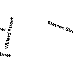
60 STETSON ST
Owner Information
URBINA DAVID
60 STETSON ST
BRAINTREE, MA 02184


Property Details
60 STETSON ST is classified as a Single Family Residential (Bungalow).
The primary structure on this property was built in 1925. There are 1,517ft2 of built area within this property. There is 1,517ft2 of residential/living space within this property. This property is listed as having 4 rooms.
60 STETSON ST is valued at $469,600. The land is valued at $264,400 and the structures are valued at $205,200.
This property is in Zone B. Confirm with local Zoning Board authorities to ensure there are no overlays or other easements on this property.
60 STETSON ST was last sold on Monday, November 7, 2005 for $1.
Assessment data from fiscal year 2022.
Flood Data
According to the FEMA National Flood Hazard Layer, this property does not appear to be in a flood zone. It may also be in an area not yet reviewed. Nonetheless, confirm this information prior to taking any action.
To view the flood hazards around this property, create a FEMA "Firmette" Map of the area around 60 STETSON ST.
Broadband Internet Providers
| Provider | Type | Bandwidth (mbps) | |
|---|---|---|---|
| Verizon New England Inc. | DSL | 1 | 0 |
| Viasat Inc | Satellite | 100 | 3 |
| GCI Communication Corp. | Satellite | 0 | 0 |
| VSAT Systems, LLC. | Satellite | 2 | 1 |
| HughesNet | Satellite | 25 | 3 |
| Comcast | Cable | 1000 | 35 |
| Verizon New England Inc. | Fiber | 940 | 880 |
Broadband service provider data from December 2020.
Adjacent Properties
- 0 AVERY RD
Undevelopable Residential Land owned by FITZGERALD LISA B TR - 72 FAXON ST
Single Family Residential owned by FITZGERALD LISA B TR - 76 FAXON ST
Single Family Residential owned by JOHNSON KYLE A - 64 STETSON ST
Single Family Residential owned by YAO WEIQI - 0 AVERY RD
Vacant, Selectmen or City Council (Municipal) owned by BRAINTREE TOWN OF